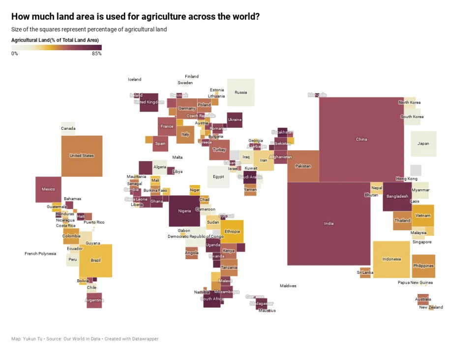
Developing and undeveloped countries remain to be the agricultural countries, made in QGIS
Dec 2020 · Interactive maps
A world cartogram of squares, one per country and sized by population, shaded by the share of land used for agriculture, from Our World in Data. Hover a square for its exact share, or zoom in.
Client: Personal. Tools: Datawrapper.
Open project